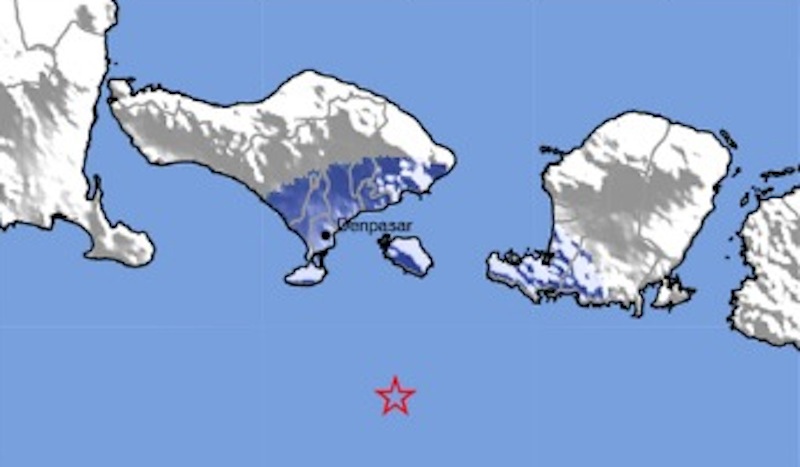
An earthquake with a 4.4 magnitude was recorded about 60 kilometers off Bali’s southern coast on Thursday afternoon.
The earthquake struck at 12:44pm local time, at a depth of about 76 kilometers, according to data from the Meteorology, Climatology and Geophysics Agency (BMKG).
“There was an earthquake this afternoon with the epicenter in the sea, 59 kilometers southwest of Klungkung,” BMKG staff member Lestari Naomi told Tribun Bali.
At 4.4 on the richter scale, the quake was just a small one, but could be felt by some in south Bali.
“The earthquake was felt in Tuban and Nusa Dua. Until now, we’ve received no reports of related damage,” Naomi said.
BMKG says the quake was too shallow to raise the red flag for tsunami potential.
“The depth was shallow, at 76 kilometers,” Naomi said.
Bali’s experienced some shaking from a number of quakes in the past couple months, with a 6.4 on March 22, a 5.4 on March 17, and in February, two 5.2 quakes and a 4.9.
While earthquakes are not exceedingly common in Bali, the recent quakes are a reminder that something bigger may be quietly lurking under the surface because of Bali and south Java’s positioning over a subducting slab. This “sleeping tectonic dragon” could one day manifest in the form of one or several large earthquakes and tsunamis, writes Earth Observatory of Singapore’s Kerry Sieh.
Although this theory remains unproven at the moment, it is something to think about, cautions Sieh.


Reader Interactions