
Indonesia’s volcanology center has downsized the exclusion zone for Mount Agung, the smoking and rumbling volcano on resort island Bali.
The Volcanology and Geological Disaster Mitigation Center (PVMBG) bumped the danger zone down on Thursday from the previous radius of eight to 10 kilometers around the crater to now six kilometers. The reduction will allow some locals from villages that were previously inside the danger zone to return home after weeks and weeks of evacuation.
However, the alert level—referring to the alert within the danger zone—remains “awas” (danger) level IV, the highest alert.
Area berbahaya Gunung Agung diturunkan dari radius 8-10 km menjadi 6 km dari puncak kawah oleh PVMBG. Status tetap sama AWAS. Desa yang berada dan jumlah warga di dalam radius 6 km yang masih harus mengungsi masih diidentifikasi. pic.twitter.com/emsQ5co66o
— Sutopo Purwo Nugroho (@Sutopo_BNPB) January 4, 2018
Mount Agung’s condition is still very much dynamic so people doing activities just outside the exclusion are encouraged to remain vigilant, PVMBG stated in a release put out on Thursday.
The volcano is still in an eruptive phase with relatively high but fluctuating activity, based on readings measuring seismicity, deformation at the crater, and geochemistry, the statement said.
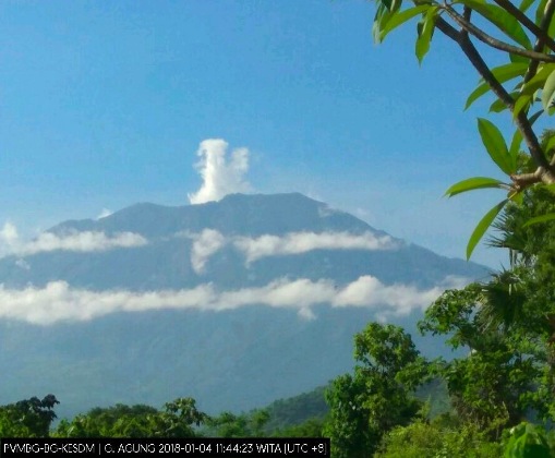
After all, the volcano did just shoot up a column of ash 1,500 meters from the crater on Wednesday morning at 11am, following a similar release on Monday evening.
The risk for stones, sand, gravel, and other debris to strike around the volcano at the moment is calculated to be no more than six kilometers, according to PVMBG. While lahar flows originating from Agung would depend on the volume of the eruption.
Given the current intermittent scale of eruptions, the potential danger for a heat cloud is relatively small, the center said.

