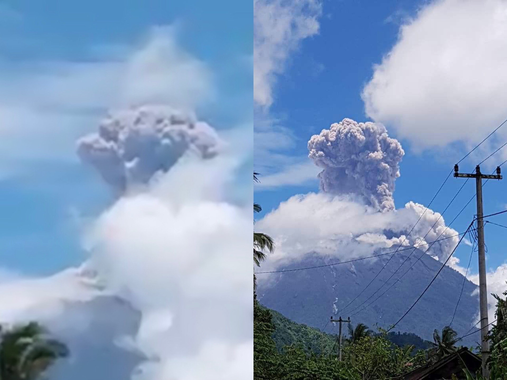

Bali’s Mount Agung spewed out a 1500-meter-high column of ash on Tuesday afternoon, just three days after the volcano’s maximum alert status was downgraded from the highest alert level of “awas” (danger) to “siaga” (standby).
The eruption was recorded at 11:49am for a duration of 146 seconds, National Disaster Mitigation Agency (BNPB) spokesman Sutopo Purwo Nugroho announced on Twitter this afternoon.
Gempa letusan Gunung Agung terjadi pada 13/2/2018 pukul 11:49 WITA dengan tinggi kolom asap dan abu 1500 meter di atas puncak. Status Siaga (level 3). Zona berbahaya di dalam radius 4 km dari puncak kawah. Sebanyak 15.445 orang masih mengungsi tersebar di 146 titik pengungsian. pic.twitter.com/7Ga1oRofzu
— Sutopo Purwo Nugroho (@Sutopo_PN) February 13, 2018
Despite today’s eruption, the volcano remains on standby status for an exclusion zone set at a radius of four kilometers from the crater.
Bali remains safe outside of this exclusion zone, authorities maintain. Mount Agung is located in Bali’s Karangasem regency, about 75 kilometers from the tourist hub of Kuta.
BNPB estimates that there are at least 15,445 people still evacuated from villages on the slopes of Mount Agung.
The downgrading of Agung’s status this past weekend actually knocked down the exclusion zone down from six to four kilometers, which permitted all remaining evacuees to return home, but many say they have decided to stay evacuated because of the poor road conditions in their villages.
Villagers have been voicing concerns that they wouldn’t be able to get away quickly if another emergency came up or if the volcano started erupting again—like it did today.
Lahars, destructive mud flows with volcanic materials, did a number on some roads since Agung started erupting.


Reader Interactions