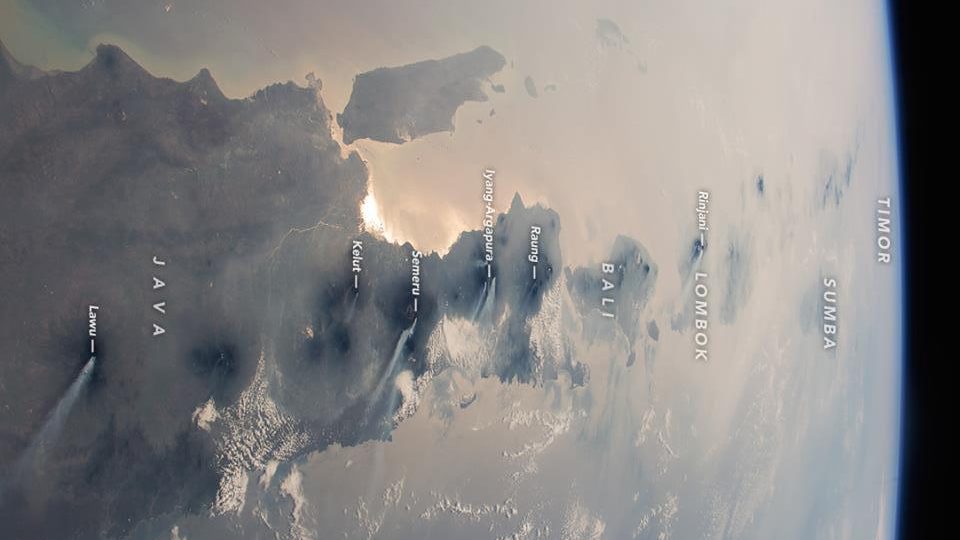
We’ve seen some incredible imagery of Bali thanks to the drone craze that’s been sweeping the globe, but one astronaut aboard the International Space Station gives all our resident ‘droners’ a run for their money.
A photo captured way up above from the ISS during a rare clear moment—the view of Indo from space is apparently usually obscured by cloud cover—shows part of Indonesia laid out like a map. In the image, you can very clearly see East Java, Bali and Lombok, with Sumbawa, Sumba, and other islands to the east trailing off.
At least six volcanoes can be spotted emitting steam and smoke during the ISS orbit, according to NASA. Imagine watching a volcanic eruption from space—astronauts are sent memos on the reg from Earth about dynamic events to observe, like wildfires and volcanic eruptions.
The photo isn’t a new one—it was acquired by NASA in October 2015—but it’s recently gone viral, making the social media rounds in Indonesia based on a post that was first shared to Facebook by NASA Earth about a year ago.
https://www.facebook.com/nasaearth/photos/a.10150660751157139.441503.57242657138/10154074988767139/?type=3&theater


