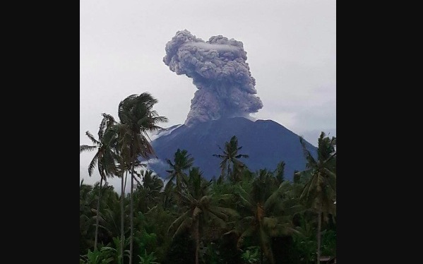
Indonesia’s volcanology center recorded four eruptions at Mount Agung on the island of Bali, early on Tuesday morning.
The eruptions occurred from 2:31am to 2:57am, according to senior volcanologist, Devy Kamil.
The center was unable, however to properly measure the height of the ash column because of cloudy conditions at the volcano, which stands at 3,142 meters, Kamil said.
Winds were blowing east and southeast, so away from the island’s Ngurah Rai International Airport, which lies about 75 kilometers to the southwest of Mount Agung. Flights have been going on as usual, and the aviation alert is still on orange, the second highest level. If the level goes up to red, as it did for a two and a half day period in November, flights would be grounded–but unlikely at the moment thanks to present wind patterns.
Mount Agung’s alert level remains at the highest alert level, where it’s been since Nov. 27, 2017.
The alert level refers to the danger in the exclusion zone, which is set at a radius of six kilometers from Agung’s crater. The rest of Bali is still safe, according to PVMBG.
The volcano had already previously erupted this month on January 15 and January 11.
Drone footage at the volcano’s crater had just been taken yesterday:
Kondisi kawah Gunung Agung terkini yang diambil dari drone PVMBG pada 22/1/2018. Kubah lava baru mengisi sepertiga volume mangkok kawah G. Agung. Telah terjadi 4 kali erupsi pada 23/1/2018. Status Awas. Bandara normal #balilife #bali #volcan #volcano #volcanoes #volcanic pic.twitter.com/7wapxCKe1b
— Sutopo Purwo Nugroho (@Sutopo_PN) January 23, 2018


