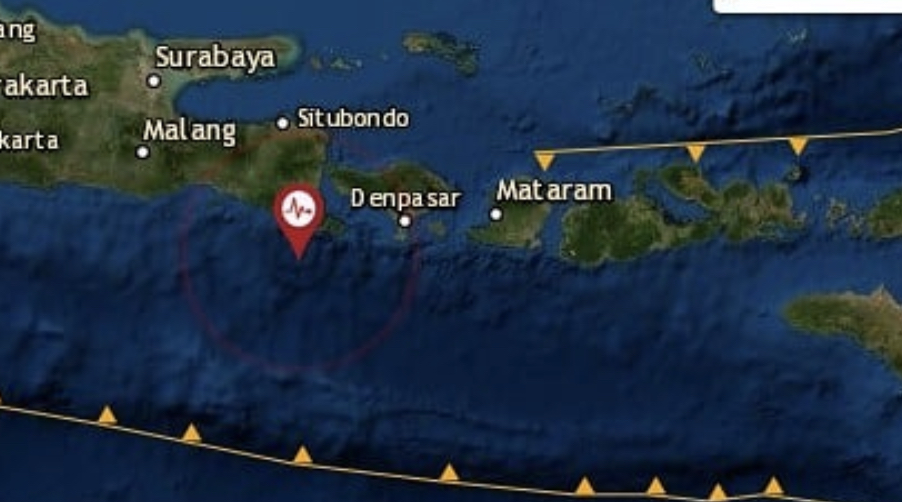

An earthquake measuring 4.9 in magnitude struck off the coast of Bali this morning, with tremors reportedly felt in Kuta and Denpasar, as well as Gianyar and Tabanan regency.
According to Indonesia’s Meteorological, Climatological and Geophysical Agency (BMKG), the quake’s epicenter was 84 kilometers southwest of the island, hitting at a depth of 71 kilometers at 9.29am.
The United States Geological Survey (USGS), however, reported that the quake had a magnitude of 5.1.
The quake, which BMKG later revised to 4.6-magnitude, lasted for about 10 seconds, with tremors reportedly being felt in Banyuwangi and Jember in East Java, and even the northern parts of Lombok island in West Nusa Tenggara. There has been no immediate reports of major damage or injuries.
Just last week, a 5.8-magnitude earthquake struck off the coast of Bali, injuring a total of eight people, one of whom were heavily injured, according to the Bali Regional Disaster Management (BPBD). Dozens of buildings were damaged as a result of the earthquake on July 16, most of which were located in Badung regency.
NOTE: This story has been updated to include BMKG’s revision of the magnitude of the earthquake’s that struck off the coast of Bali on July 24.

