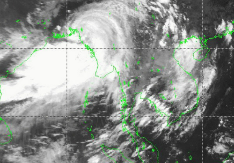

For the past week, heavy rain has pounded parts of Myanmar and Bangladesh due to an area of low pressure – called a tropical depression – that on Wednesday morphed into a cyclone. Worst affected have been Chin and Rakhine states, where aid operations are underway. Cyclone Komen has now made landfall in coastal Bangladesh, and is predicted to weaken, but more bad weather is on the way for Myanmar. Heavy wind and rain pose a further threat, especially to the Ayeyarwaddy Delta area, which was devastated by Cyclone Nargis in 2008. Here’s leading meteorologist U Tun Lwin.
What is going on with Cyclone Komen?
It is now moving towards the Northwest. Some of the cloud associated with the storm will affect the Arakan (Rakhine) coast but not the storm center.
What will happen in the next 12 hours?
Across the country they are still going to face heavy rain in Chin state and the Rakhine coast. Another storm is forming in the North Bay of Bengal and so that will bring another heavy rain to coastal areas like Delta areas and Mon State.
How strong is that storm?
It is in the category of cyclone. The wind speed is about 75 mph. It is strong.
How will that storm affect the country?
Normally the monsoon becomes stronger when there is a storm in the Bay of Bengal. One bad thing is most of the area in the country is now experiencing flooding. The current storm will probably increase the water level, especially in the Delta area.
How much rain are we talking about?
In Rakhine and Chin states I’m expecting at least 5 to 7 inches in 24 hours, and 3 to 4 inches in the Delta.
How will Yangon be affected?
Yangon is within the heavy rain area so at least 1 to 3 inches.
Which areas are you most worried about?
After one or two days we can expect improvement in Chin and Rakhine states. The Delta area will experience very bad weather.
Photo / Department of Meterology and Hydrology

