As one of the most active volcanoes in the country, Taal Volcano has been the source of some of the most destructive and deadly volcanic eruptions in Philippine history, with records going as far back as the 16th century. There is no shortage of historical accounts of Taal over the centuries, including accounts of the eruption of 1911—one of the most destructive and deadly natural disasters of that era.
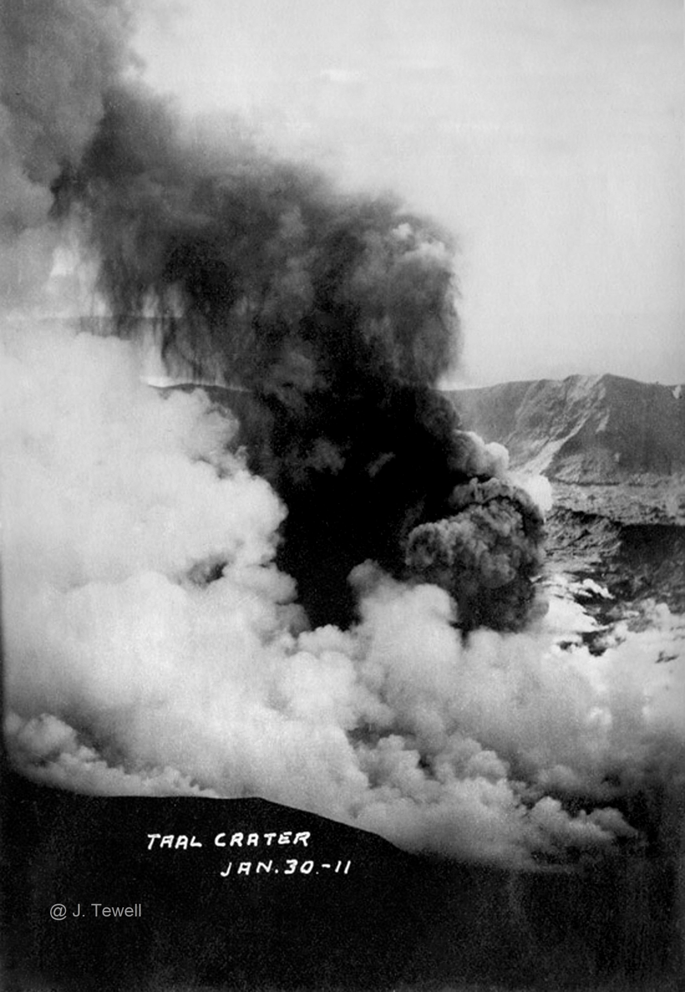
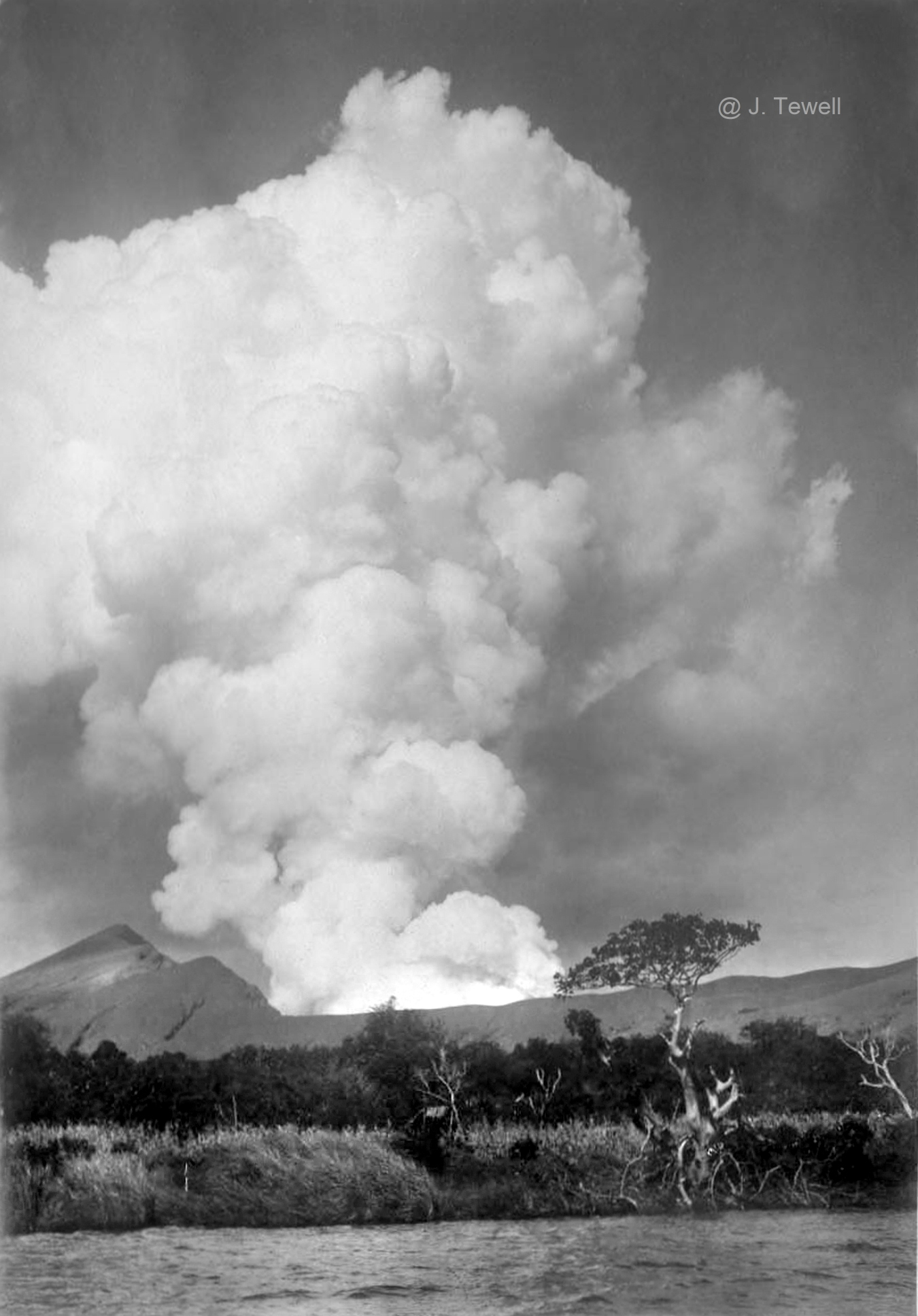
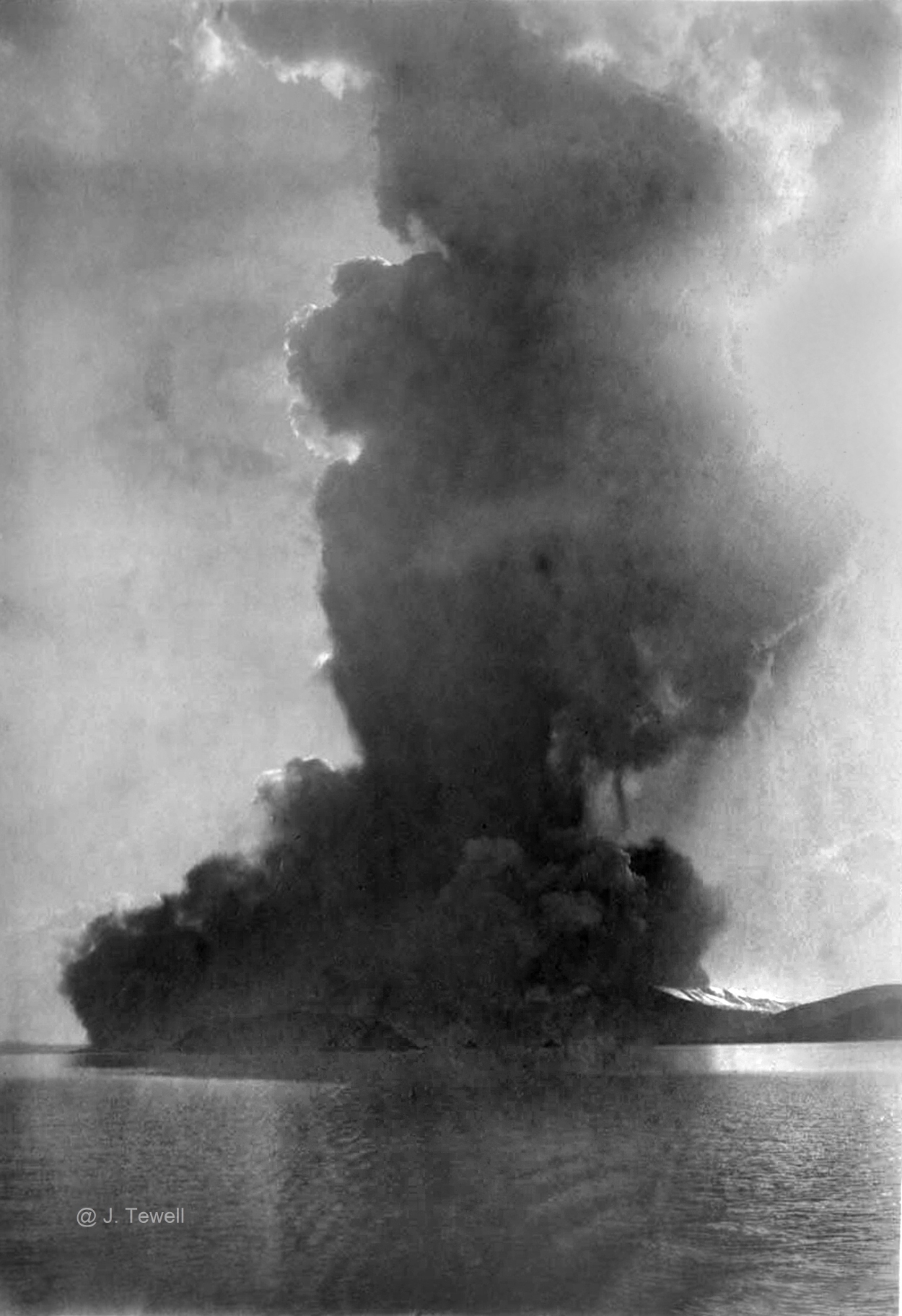
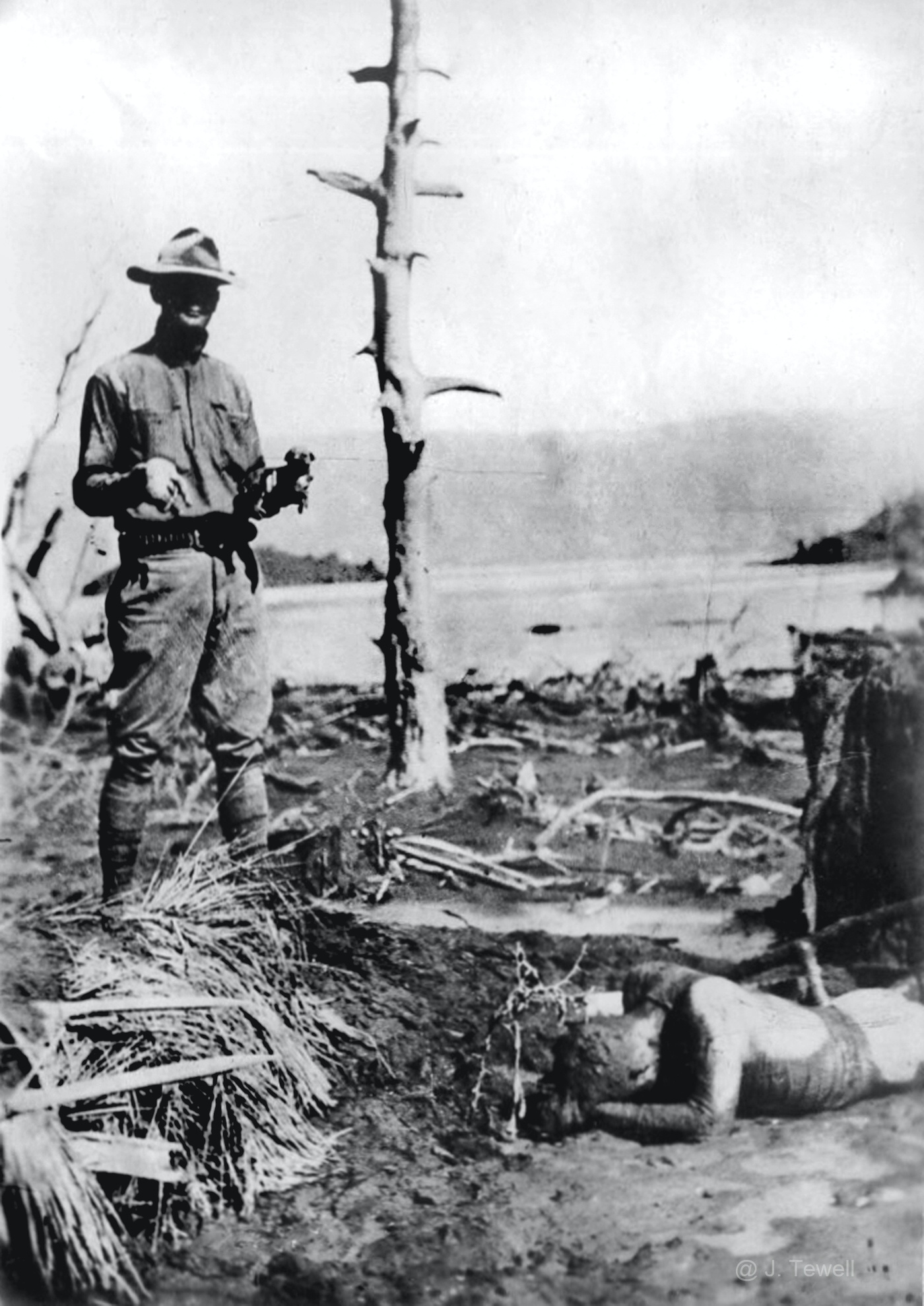
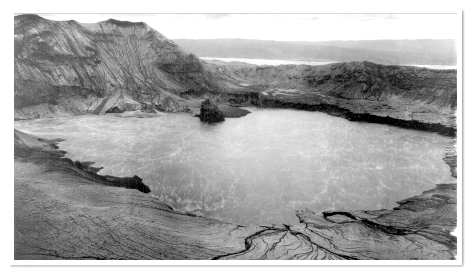
Nothing quite drives home the awe-inspiring force of the 1911 eruption as the photographs that have survived from that time. Amateur photo archivist John Tewell, whose online collection includes over 10,000 photos from different periods of Philippine history, owns a few original prints of the 1911 Taal eruption.
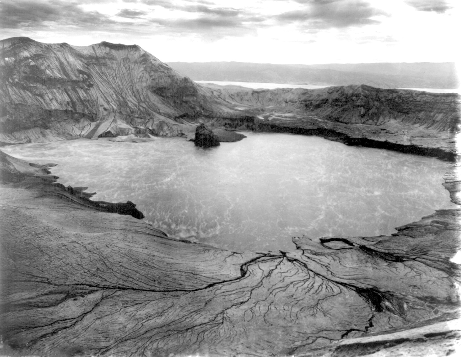
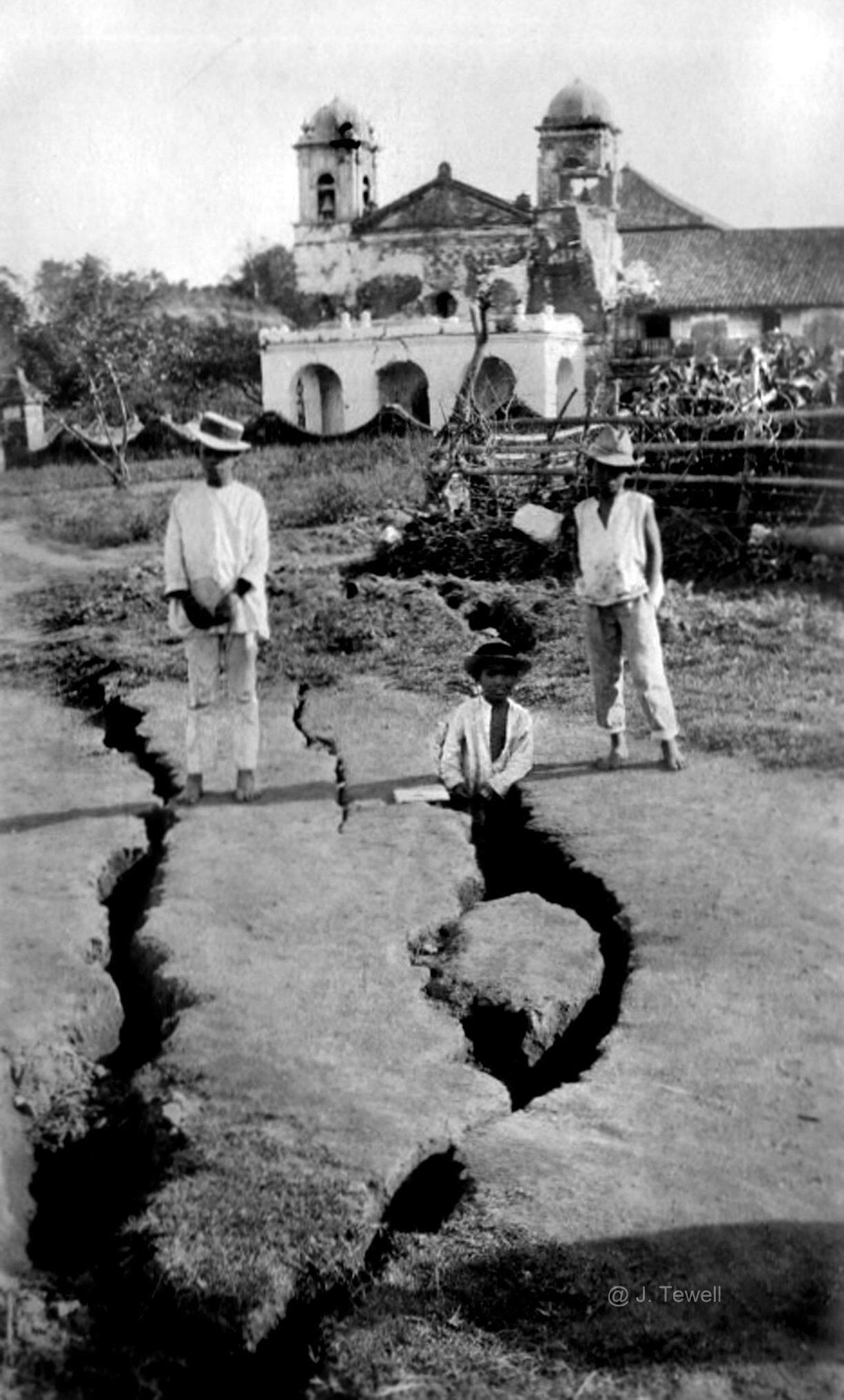
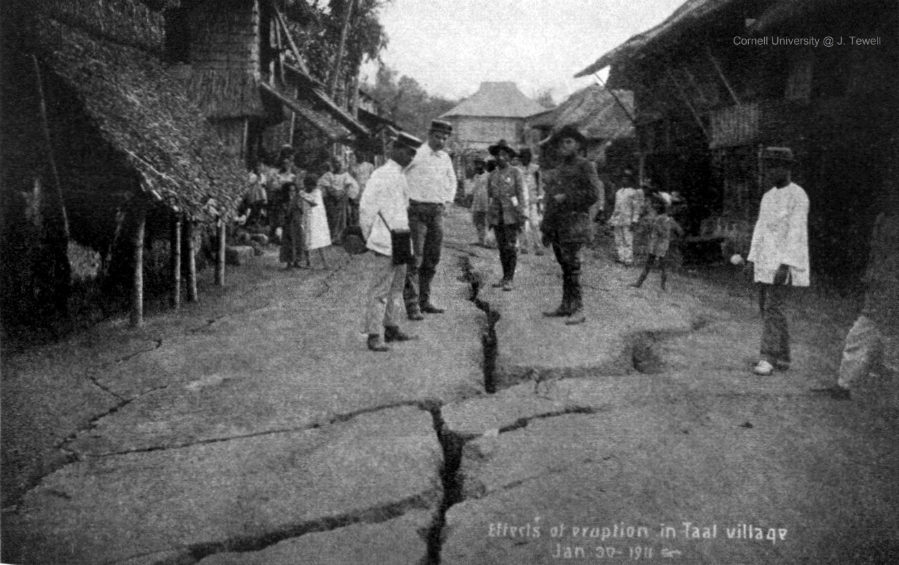
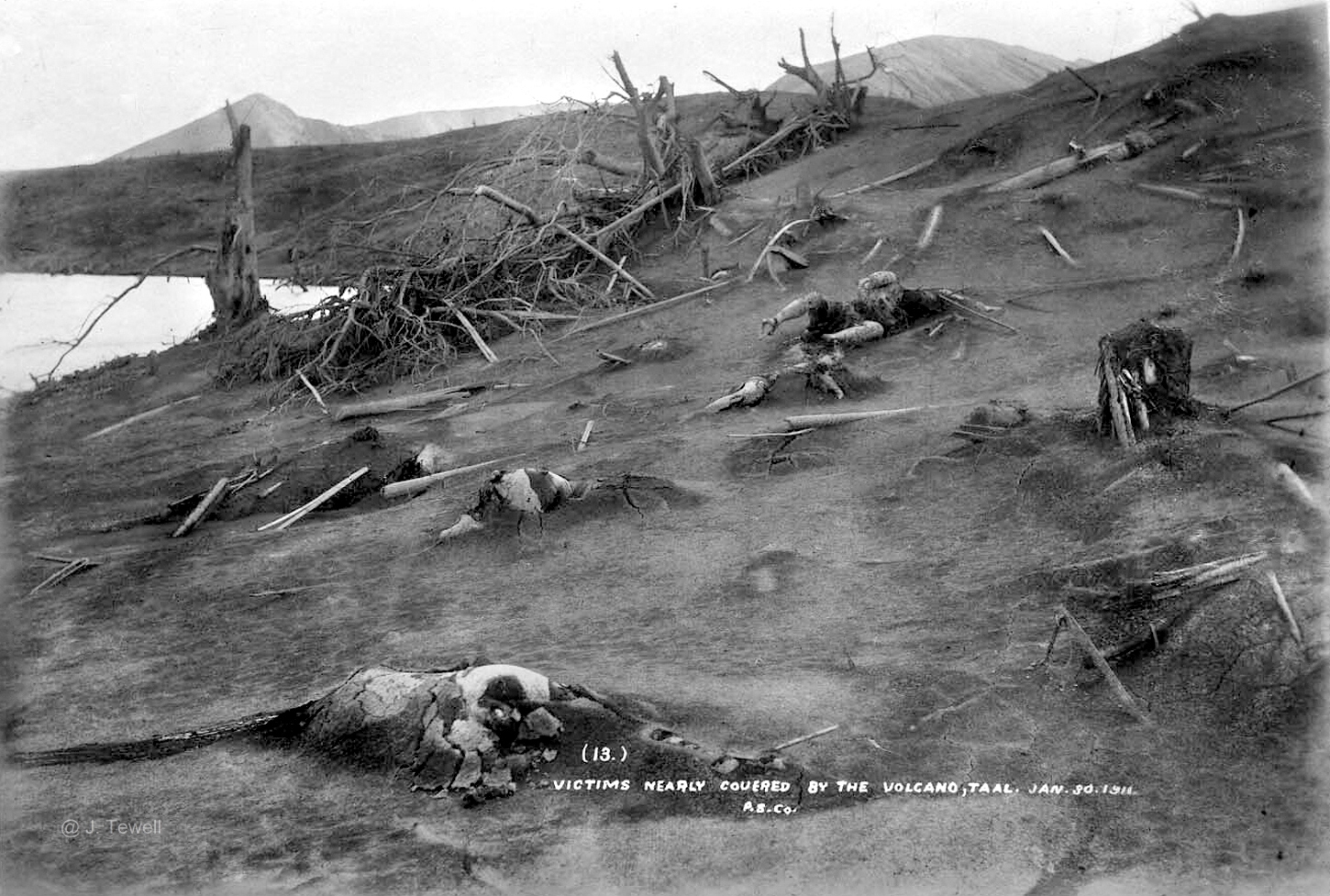
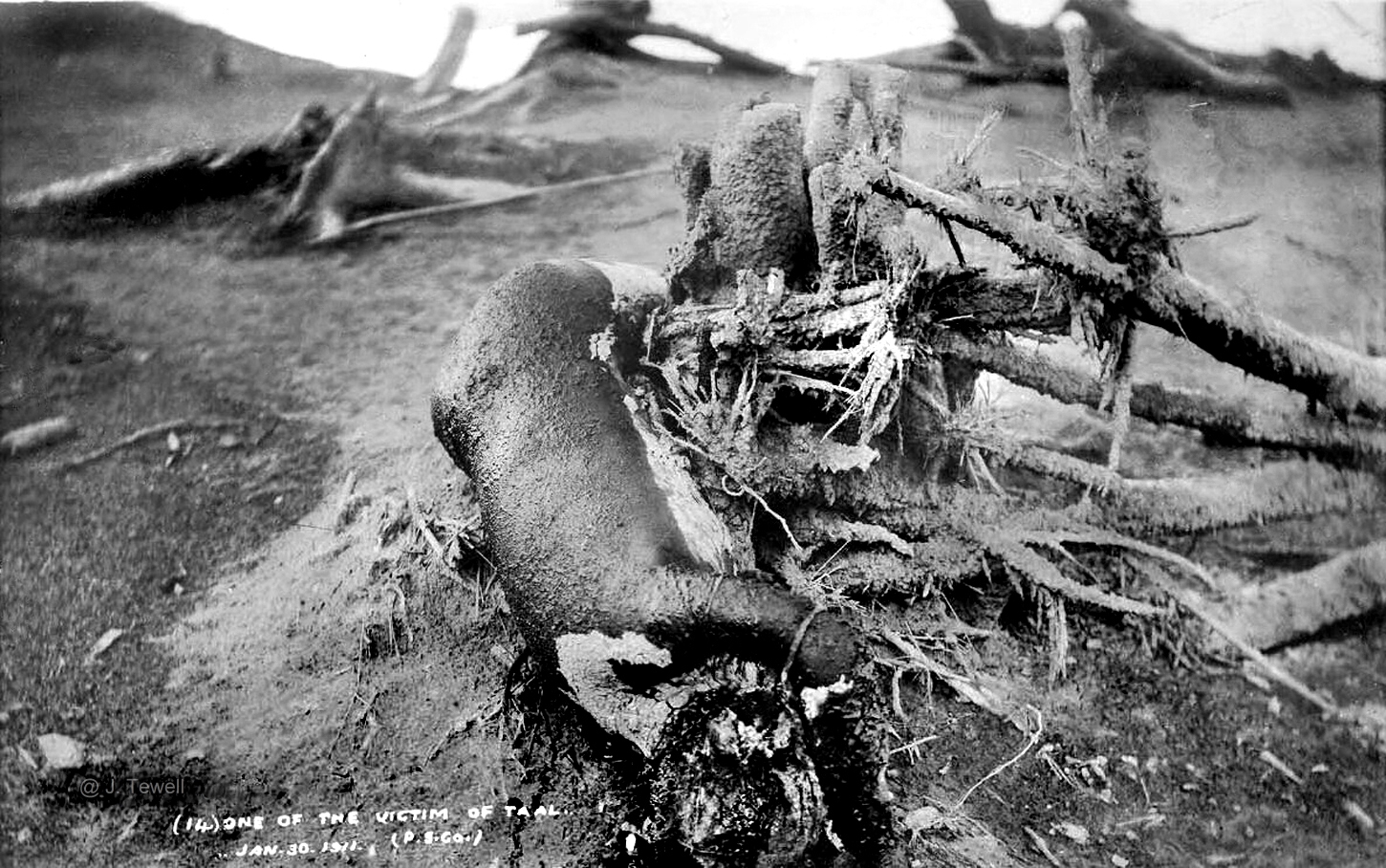
These images—some of them quite graphic—show the immense destruction that the 1911 blast had wrought upon the area. Not only did the eruption cause the landscape itself to change, it also killed as many as 1500 people from sheer heat and force, not by lava flows.
Taal erupted in the early hours of January 30, 1911, with a blast that was so loud it was heard in Manila, 60km away. Volcanic lightning was seen over Taal, along with a huge, black, fan-shaped cloud. That black cloud shot up into the sky at around 2:30am, marking the peak of the eruption.
That black cloud marked a hot blast of steam and gases that traveled down the slopes of the volcano, accompanied by a shower of superheated mud and sand. This blast scalded everything in its path, killing everyone and everything on Taal Volcano Island.
When authorities reached Taal in the following days, they found a completely desolate island, completely destroyed by the eruption. All vegetation on the volcano’s slopes were bent away from the crater, suggesting the force of the blast. Very little of the vegetation was burned or scorched, and no trace of lava was found anywhere.
_____________________
Also read: This guy adds color to black and white photos from Philippine history
_____________________
All seven barangays that were on Taal Volcano Island were completely destroyed, with no survivors. Post mortem examination showed that the victims had died from the heat, scalded by the hot gases or mud.
The blast had also reached the west shore of Taal Lake, flattening some villages and destroying crops. The land itself showed great changes. Before the blast, the crater was supposed to have had several openings, forming lakes of different colors—a green lake, a yellow lake, and a red lake—along hot springs. After the eruption, the lakes were gone, with one large lake taking their place.
These days, cameras and recording equipment from the Department of Science and Techonology’s Philippine Institute of Volcanology and Seismology (PHIVOLCS-DOST) ensure the constant monitoring of the volcano. After a powerful eruption in January 2020, Taal Volcano Island has been declared a permanent danger zone.
These images, used here with permission from John Tewell, serve to remind us of the unspeakable destruction that Taal has wrought in the past, and can very well unleash again.
_____________________
Also read: Taal Volcano vents a 2.5-km high plume into the sky (PHOTOS)
_____________________
===Content warning: graphic images ahead ===
