
Singapore seems to have a love-hate relationship with drones, with Parliament recently pushing forward a bill that will require all drone operators to get a permit to fly them and severely restricting their flight as well.
The Urban Redevelopment Authority (URA) however has taken an interest in these new flying machines, as they’re currently exploring using aerial images to create 3D digital models of Singaporean landscapes.
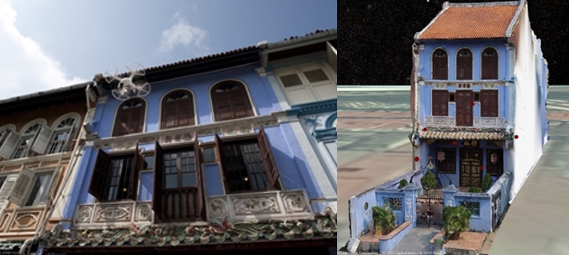
URA and local drone start-up Avetics have been working on a trial to conduct photogrammetry — the science of making measurements from photographs — and use drones to create a 3D digital model of the NUS Baba house along Neil Road.
The aim is to document conserved buildings in a more intricate and accurate detail which planners can use to carry out research, guide restoration, as well as monitor and manage the state of built heritage in a more effective way. Drones would also be able to allow conservation planners to inspect rooftops and other aspects of conserved buildings without having to physically scale them.
The URA is also exploring the construction of 3D digital models with accurate details of the profile, terrain and contours of urban environments using drones — plans to create 3D digital models of Pearl’s Hill district and Chinatown area are in the works.
“(Drone technology) allows us to conveniently capture and generate high-quality, precise 3D digital models of buildings that we used to take weeks to do, and at a lower cost,” says URA CEO Ng Lang. “It is among the range of tools we are experimenting with now that will transform the way we plan for Singapore.”
Photo: URA newsroom

