
If you’re wondering how just how bad current haze conditions is right now, know that it’s already come to the attention of NASA themselves, who’ve taken a breathtaking (literally) image of the smog from their Landsat 8 satellite. Check out satellite photograph in all its full-sized glory here.
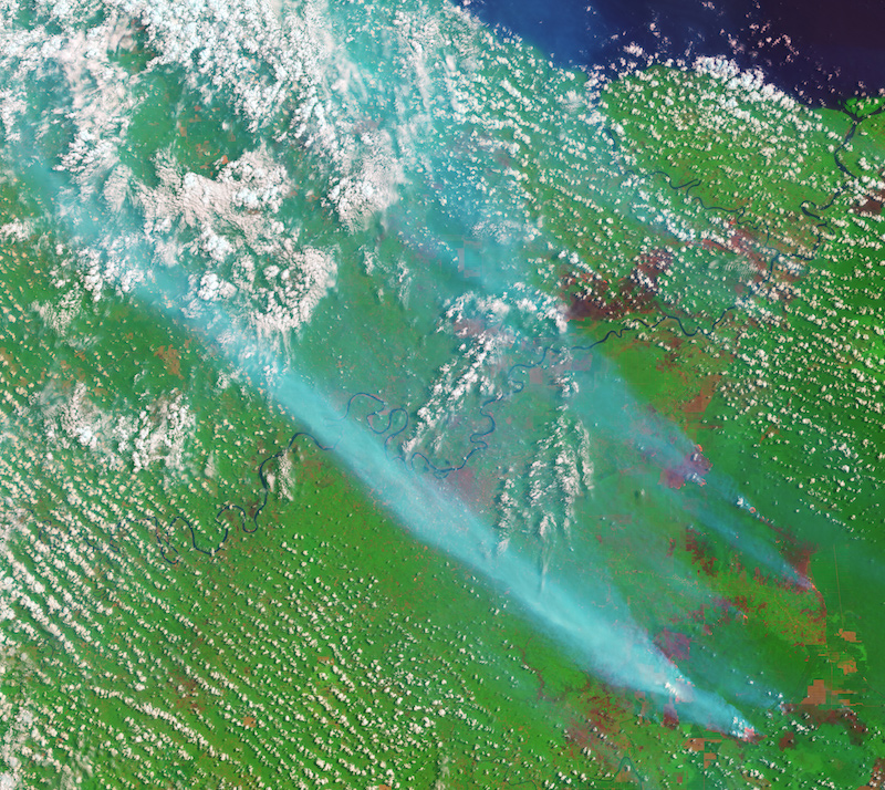
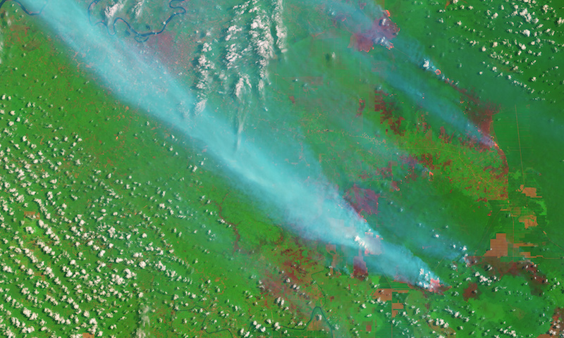
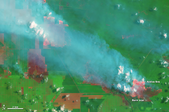
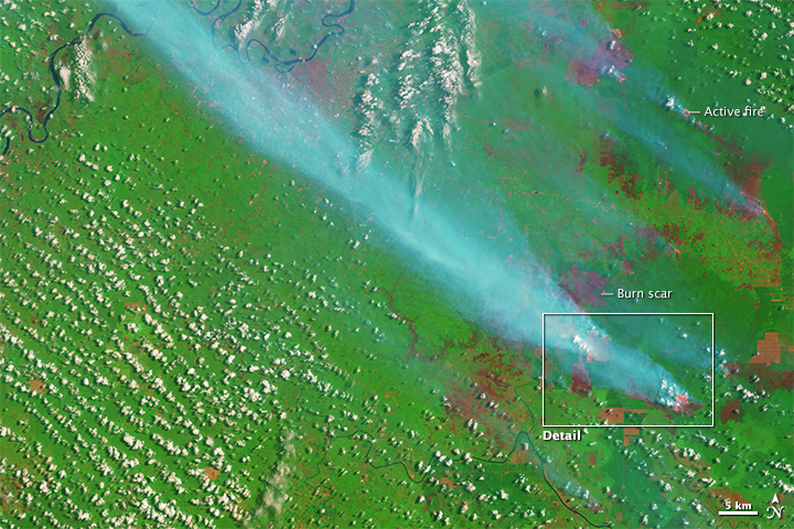
This spectacular image taken by NASA’s Operational Land Imager has been false-colored using visible and infrared light — so fires and freshly burned land really pop out. Those glowing orange spots you see are actually fires, while the dark red specks are newly burned land.
You might think that this image taken on Sep 5 looks pretty worrying, but just imagine how it’d look like now, considering that the fires have only gotten worse. The data they’ve captured and analysed all the way from space is pretty on point too:
“The fact that the fires burned within well-defined rectangular grids suggests that these are agricultural fires that were intentionally set by growers. According to land-use maps published by Global Forest Watch, the fires are burning within a palm oil plantation. Palm oil production is highly profitable, and the commodity is an important export for Indonesia, the world’s largest producer.”
We’ll update with more of NASA’s pictures.
Photos: NASA.gov

