
If history’s not your best subject, perhaps this new local app will be of use. In an attempt to frame the past in a way that’s simple and easier to digest, BalikSG maps out an augmented reality (AR) trail across the Singapore River and Fort Canning, bringing users on a condensed journey through events, places, and personalities significant in the area’s history.
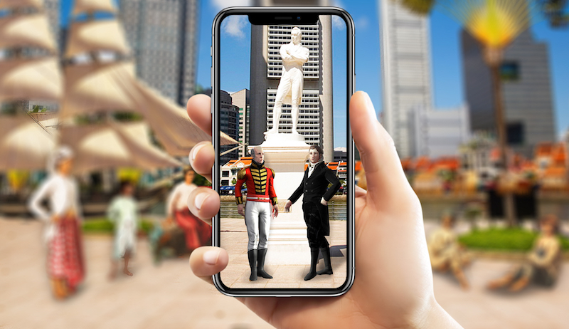
The free-to-download app, created by the National Heritage Board and National Parks Board as part of the Singapore Bicentennial commemoration, puts an interactive spin on things we’ve already learned in school — like the landing of Stamford Raffles and William Farquhar in 1819.
Clearly, it’s one of the government’s many attempts to reach out to the tech-obsessed generation, to tell the story of Singapore 200 years ago in a way that isn’t dry or dull. And it works, but only if you have the patience to traipse across the two trails in search of landmarks to engage with the app. Think of it as a Pokémon Go for history, if you will. (Gotta catch ’em all — the AR markers, we mean.)
The Singapore River trail, which just launched yesterday, takes you through eight stops across 2km along the waterfront to hear from the early settlers who came to Singapore, including the likes of Chinese coolies, Indian Chettiars, Baweanese immigrants, and Raffles and Farquhar engrossed in a “probable conversation” after they landed on our shores.
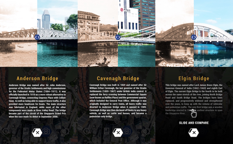
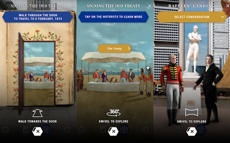
From the Raffles landing site (by the Raffles statue), you can head to Elgin Bridge, Anderson Bridge, and Cavenagh Bridge to learn how their surroundings have changed through the years, followed by a peek at the signing of the 1819 treaty between Raffles, Temenggong Abdul Rahman and Sultan Hussein Shah of Johor, which allowed the British East India Company to set up a trading post in Singapore, in front of the National Gallery of Singapore.
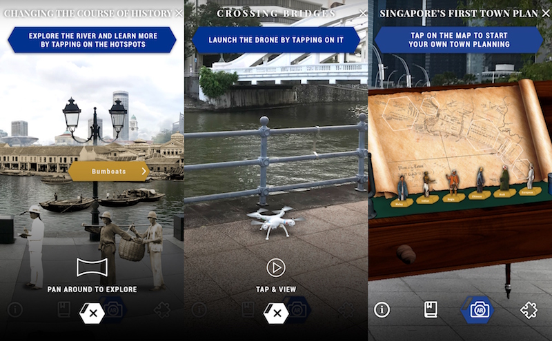
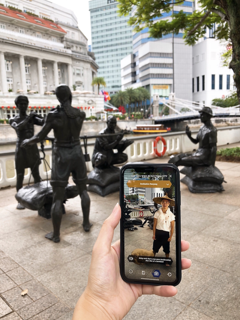
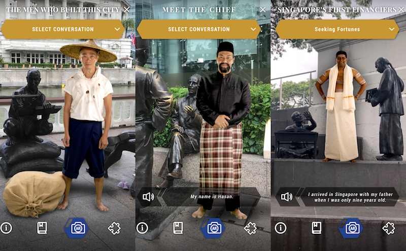
When you get to Esplanade Park, you’ll find a blueprint of Singapore’s first town plan from 1822, drafted by Lieutenant Jackson, an engineer and land surveyor from the British East India Company who oversaw the country’s development. Then at Empress Lawn, hear life stories from Singapore’s first financiers from the Chettiar community, Chinese immigrants who worked as coolies in the construction, shipping, and agriculture industries, and a Baweanese pondok (communal shelter) chief.
Lastly, the Boat Quay pitstop shows you what the now-clean river once looked like in the 1880s, when it was full of bumboats and lined with shop houses and warehouses.
As for the Fort Canning Trail, that’ll be launched in June this year, so check back for more deets then.

