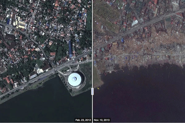

The “before and after” maps of Tacloban, published by The Wall Street Journal, have been going around in various social media channels as they may best illustrate and give perspective of the extent of damage that Tacloban has suffered from Yolanda. The ‘after’ photos were from two days after Yolanda, the biggest storm to ever make a landfall in recorded history, swung by the country and flattened the Visayas region. See more maps at WSJ. They’re very gripping and will make you want to help as soon as you can.
Photo is a screenshot from The Wall Street Journal

