
Typhoon Jose entered the Philippine area of responsibility (PAR) on Saturday night, August 2.
“The Philippine Atmospheric, Geophysical, and Astronomical Services Administration (PAGASA) said that Jose will continue to affect the northern part of the country, intensifying the effects of the southwest monsoon affecting Luzon,” reports ABS-CBNnews.com.
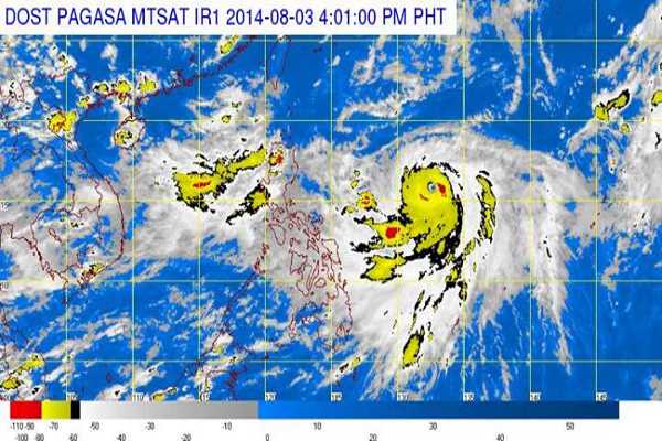
As of 4pm on Sunday, Jose was spotted 1,020 kilometers east of Casiguran, Aurora. It was packing maximum sustained winds of 195 kilometers per hour (kph) near the center and gusts of up to 230 kph.
PAGASA said the typhoon is not expected to make landfall and will be out of PAR by Thursday morning, August 7.
The report noted though that “the Ilocos region and Central Luzon will experience monsoon rains, which may trigger flashfloods and landslides.”
The report also added: “Metro Manila and the rest of Luzon will have occasional rains. Visayas and Caraga region will have cloudy skies and light to moderate rainshowers and thunderstorms. The rest of Mindanao will be partly cloudy to cloudy with isolated rains and thunderstorms.”
Image from PAGASA

