
Got a tip? Send it to us at manila@coconuts.co.
According to the latest advisory from the Philippine Atmospheric, Geophysical and Astronomical Services Administration (PAGASA), the typhoon with the international name “Maysak” has intensified.
It is expected to enter the Philippine Area of Responsibility (PAR) by Wed evening, Apr 1, or early Thu morning, Apr 2, and will be named “Chedeng”.
“PAGASA weather forecaster Aldczar Aurelio said once it enters PAR, it will not yet directly affect the country but will bring rains and winds by Friday or Saturday over Northern or Central Luzon,” reports Manila Bulletin.
Aurelio explained that “the typhoon is expected to make a landfall in Northern Luzon but if its movement recurves, it will not make landfall.”
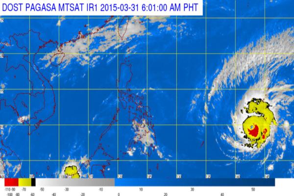
At 4pm on Tue, Mar 31, Typhoon “Maysak” was estimated based on all available data at 1,690 kilometers east of Surigao City, Surigao Del Norte. It had maximum winds of 175 kilometers per hour (kph) near the center and gustiness of up to 210 kph. It is forecast to move west northwest at 20 kph.
Photo: PAGASA

