
We hope your rain gear is ready.
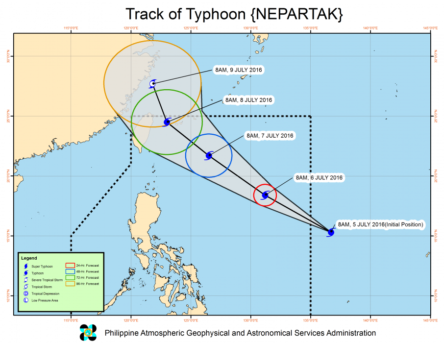
Tropical cyclone Nepartak intensified into a typhoon mid-day Tue, Jul 5, and is expected to enter the Philippine area of responsibility (PAR) this afternoon.
In an update at 11am, the Philippine Atmospheric, Geophysical and Astronomical Services Administration (PAGASA) said that Nepartak packed maximum sustained winds of 120 kilometers per hour near the center and gusts of up to 150 kph.
Once Nepartak enters PAR, it will be called Typhoon Butchoy. “It was last tracked 1,570 kilometers east of Baler in Aurora. It has a speed of 30 kph northwest. It is expected to be 1,010 kilometers east of Aparri, Cagayan by Wed morning, Jul 6,” report Frances Mangosing and Jaymee Gamil on Inquirer.net.
The report noted: “PAGASA earlier said that Butchoy won’t make landfall but it will enhance the southwest monsoon in the western portion of the country until the weekend Pagasa advises the public to remain alert for the next weather bulletin, and disaster risk reduction officials to ‘take appropriate actions.'”

