
Got a tip? Send it to us at manila@coconuts.co.
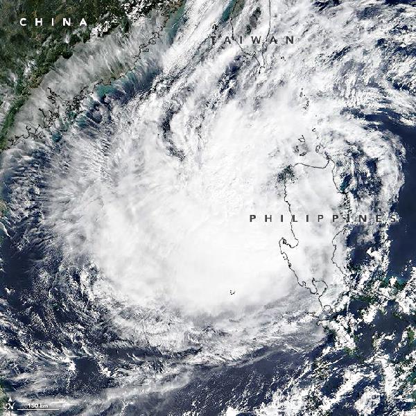
The National Aeronautics and Space Administration (NASA) shared this satellite image of Typhoon Lando (international name: Koppu) on its Facebook page.
“At 11:05 a.m. local time (03:05 UTC) on October 19, 2015, the Moderate Resolution Imaging Spectroradiometer (MODIS) on NASA’s Terra satellite acquired this image of Typhoon Koppu (local name: Lando) over the Philippines,” reports NASA.
NASA explained that “when this image was acquired, the typhoon was a Category 1-strength storm with maximum sustained winds of about 130 kilometers (80 miles) per hour.”
On Oct 17, the storm attained super typhoon status with 240 kilometer (150 mile) per hour winds. Then, it continuously weakened until it was eventually downgraded to a tropical storm.
Photo: NASA

