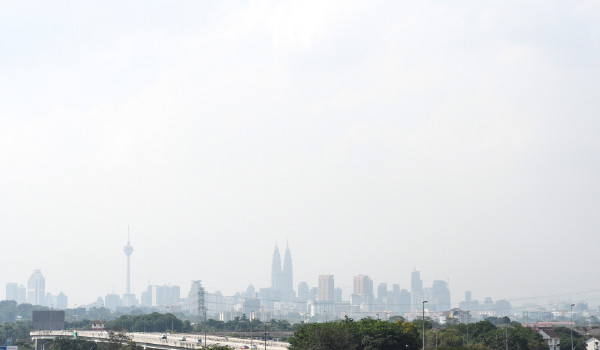

Enjoying the great outdoors might not be an option for the next few months, as estimates reveal we’ll be stuck under a near-constant haze until September.
Natural Resources and Environment Minister Datuk Seri G Palanivel said transboundary haze emanating from forest fires in Riau, Indonesia, coupled with southwesterly winds would cover the central west coast of Peninsular Malaysia with smoke for the next couple of months.
He pointed to data culled from the regional haze map and satellite imagery map by the National Oceanic and Atmospheric Administration (NOAA) released yesterday by the Asean Specialised Meteorological Centre (ASMC) based in Singapore.
“The ASMC also reported 116 hot spots detected by NOAA satellite image 18 in Sumatra on June 22,” Bernama reports Palanivel as saying today.
Already, 11 haze hot spots have been identified in Malaysia, with four in Sabah, three in Selangor, two in Negeri Sembilan, and one each in Melaka and Pahang.
He said, to deal with the dry spell, southwest monsoon and impact of the El Nino phenomenon, the ministry through the Department of Environment (DOE) had taken several initial steps, including an action plan to control open burning nationwide from February.
An open burning prohibition order had also been issued since March to date for Selangor, Melaka, Negeri Sembilan, Kuala Lumpur and Putrajaya while 194 DOE officers were empowered to arrest suspected environment criminals without a warrant, he said.
This also tallies with previous weather and climate projections for the region, which predict the El Nino phenomenon putting Malaysia and the surrounding area through a six-month long dry spell which will bring in more forest fires, haze, and drought.
See Also:
A 6-month dry season if El Nino hits Malaysia
Weather Woes: This year’s El Nino could be a repeat of 1997’s
SE Asia palm oil problems could hit consumers worldwide
This map of El Nino’s 2014 path puts us in the middle of trouble

