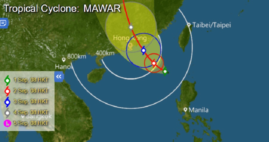

The Hong Kong Observatory will consider issuing the Standby Signal No.1 later today as Tropical Cyclone Mawar is slowly moving towards Hong Kong and expected to make landfall over the coast of eastern Guangdong on Sunday.
Mawar would be the third storm to hit Hong Kong in two weeks after Hato and Pakhar.
It is expected to follow the route set by the previous two storms, coming from the east of the Philippines while staying away from Taiwan and bringing its weight to bear in China’s Guangdong region, including Hong Kong and Macau, as it intensifies progressively.
Macau’s Meteorological and Geophysical Bureau issued the No.1 warning signal last night at about 7pm and will consider issuing a higher signal tomorrow, according to Hong Kong’s Metro Radio.
It is too early to tell whether the Observatory will issue a higher warning signal this weekend depending on the path the cyclone takes.
The weather in Hong Kong is expected to deteriorate progressively later on Saturday and Sunday with squally showers, while winds will also strengthen gradually.

