
The Hong Kong Observatory upgraded the typhoon signal to No. 8 this evening (Aug. 24) as tropical cyclone Ma-on approaches and is expected to pose a “considerable threat” to the city.
Hong Kong’s meteorological agency advised the public to take precautions with strong winds expected in the city.
In less than 24 hours, the observatory hoisted three typhoon warnings in increasing order, starting with the lowest standby signal, No. 1 at 9:10pm on Tuesday and the strong wind signal, No. 3 at 12:40pm today.
At 7:25pm today, it issued the No. 8 northeast gale or storm signal.
This means that winds with mean speeds of 63 kilometers per hour or more are expected.
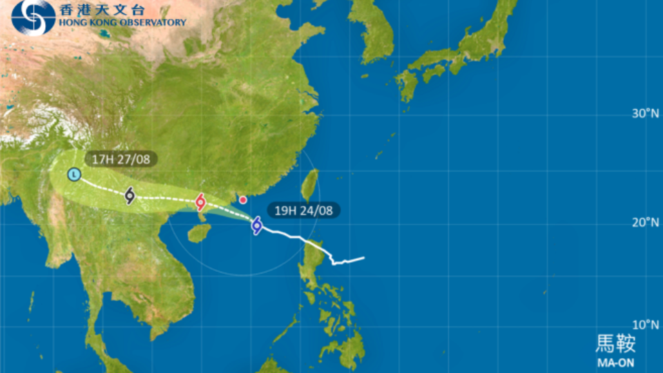
“At 7pm, severe tropical storm Ma-on was centered about 310 kilometers south-southeast of Hong Kong and is forecast to move west-northwest at about 28 kilometers per hour in the general direction of the coast of western Guangdong,” the observatory said on its website in the evening.
It added that with Ma-on edging close to the coast of Guangdong, winds over the territory have strengthened and there are occasional gales offshore and on high ground. Local winds are expected to strengthen further overnight, it said.
In the past hour, the maximum sustained winds recorded at Ngong Ping, Waglan Island and Cheung Chau Beach were 81, 78 and 69 kilometers per hour respectively, while the maximum gusts were 106, 92 and 86 kilometers per hour respectively, the observatory said at 7:30pm.
“According to the present forecast track, Ma-on will be closest to Hong Kong tomorrow morning (Aug. 25) and will skirt within 200 kilometers to the south-southwest of the territory, posing a considerable threat to the territory,” it said.
It added that the No. 8 signal will remain in force at least until 6am tomorrow.
The forecaster advised members of the public to take note of the latest weather information before departing in the morning.
It also said that seas will be very rough with swells and urged members of the public to stay away from the shoreline and not to engage in water sports.
The forecaster said that under the influence of a storm surge and astronomical high tide, a high water level of around 3 meters above chart datum, or about 1 meter above the normal tide heights, is expected at Quarry Bay between 5am and 9am tomorrow.
It said that the high water level may cause flooding in low-lying areas, adding that the public should avoid going to low-lying areas likely to be affected and stay away from dangerous places.

