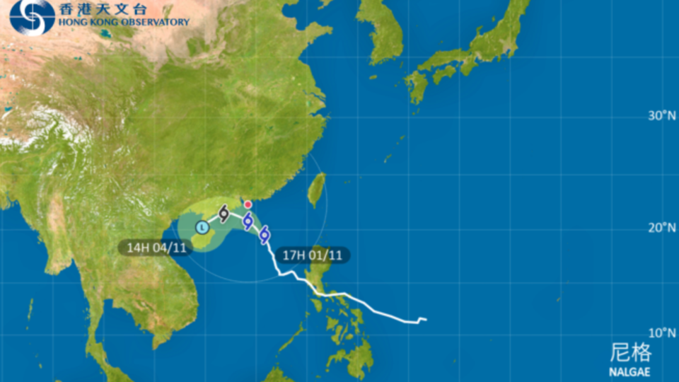
The Hong Kong Observatory will consider issuing a No. 8 typhoon warning tomorrow as severe tropical storm Nalgae approaches Hong Kong.
The strong wind signal, No. 3 is currently in force.
This means that winds with mean speeds of 41 to 62 kilometers per hour are expected.
“At 6pm, severe tropical storm Nalgae was estimated to be about 340 kilometers south-southeast of Hong Kong and is forecast to move northwest or north-northwest at about 10 kilometers per hour edging closer to the coast of western Guangdong,” said the city’s meteorological agency.
“Under the combined effect of Nalgae and the northeast monsoon, local winds are generally strong, with occasional gales on high ground.”
The forecaster said that, although Nalgae would weaken gradually, its degree of weakening remains uncertain.
According to the latest forecast, the storm will adopt a track closer to Hong Kong and skirt within around 150 kilometers to the southwest of the territory tomorrow.
Local winds are expected to strengthen progressively tomorrow.
The No. 3 signal will remain in force before 6am tomorrow.
The observatory said it will consider issuing the No. 8 gale or storm signal during the day tomorrow.
“However, the exact timing would depend on the actual variation in local winds. Please stay alert and take note of the latest weather bulletin before departing tomorrow morning,” it said.
The outer rainbands of Nalgae are affecting the northern part of the South China Sea and the coast of Guangdong. Seas are rough with swells.
Members of the public are advised to stay away from the shoreline and not to engage in water sports.
Those engaging in outdoor work or activities should also take note of the changes in weather.


