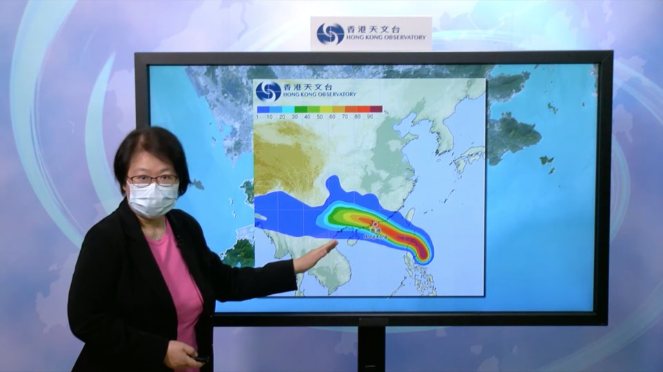
The Hong Kong Observatory is considering issuing the No. 1 typhoon signal tonight (Aug. 23) as tropical cyclone Ma-on is expected to come near the city.
The city’s meteorological agency said on its website on Tuesday that, according to the present forecast track, Ma-on will move across the vicinity of the northern part of Luzon and the Luzon Strait during the day today, and is expected to come within 800 kilometers of Hong Kong tonight.
“The observatory will consider issuing the standby signal, No.1 then,” it said.
The forecaster added that the forecast track and intensity of Ma-on remain uncertain under the influence of the terrain of Luzon.
After entering the northeastern part of the South China Sea, the tropical cyclone is expected to move northwestwards, edging closer to the coast of Guangdong gradually.
“The local weather will deteriorate significantly and winds will strengthen gradually later tomorrow (Aug. 24),” the observatory said.
Winds will strengthen further on Thursday, it said, adding there will be heavy squally showers, very rough to high seas and swells.
“Under the influence of a storm surge, low-lying areas may have flooding or backflow of seawater. Please be alert of the latest information issued by the observatory and complete appropriate precautions against strong winds, heavy showers and flooding as soon as possible,” it added.
The name Ma-on is provided by Hong Kong, which means “horse saddle” and is also the name of a peak in the city.


