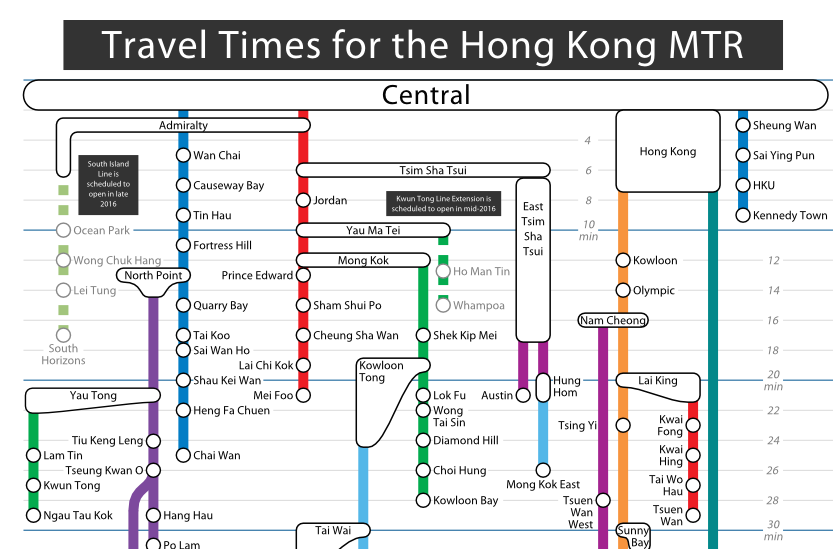

The MTR is as convenient as it gets – but how far the stops are from each other can be a bit of a mystery.
Does the train cover the distance of a short walk between two adjacent stations, like HKU and Sai Ying Pun? Or is it actually traveling a fair bit, like between University and Tai Po Market?
This interesting map, designed by Redditor carpiediem (which we assume is Latin for “seize the pie”), shows the travel times to different stations from Central.
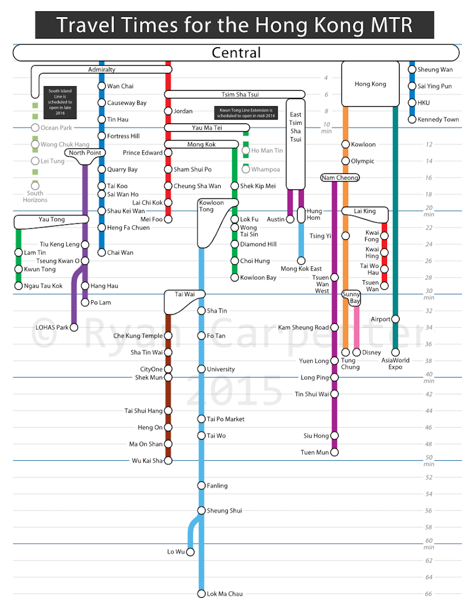
“I was curious about how to show the fastest routes to each of the MTR stations, including time on trains & waiting for them,” he wrote.
A year ago, this transportation enthusiast had a crack at creating a similar map, though he “wasn’t thrilled with the result”.
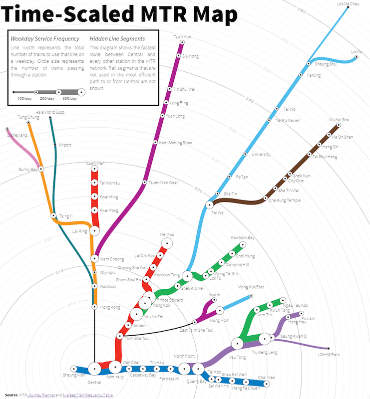
What do you think about his latest attempt?

