
UPDATE: The Black Rainstorm Warning has now been downgraded to Red (meaning 50 millimetres of rainfall per hour is expected), but the Thunderstorm and Land Slip warnings are still in force. Residents of the northern New Territories should take precautions to avoid flooding, as flash floods may occur in the area.
The Hong Kong Observatory (HKO) issued the Black Rainstorm Warning Signal at 4pm today, indicating that very heavy rain — exceeding 70 millimetres an hour — has fallen or is expected to fall.
Everyone is recommended to seek shelter immediately, and avoid high ground.
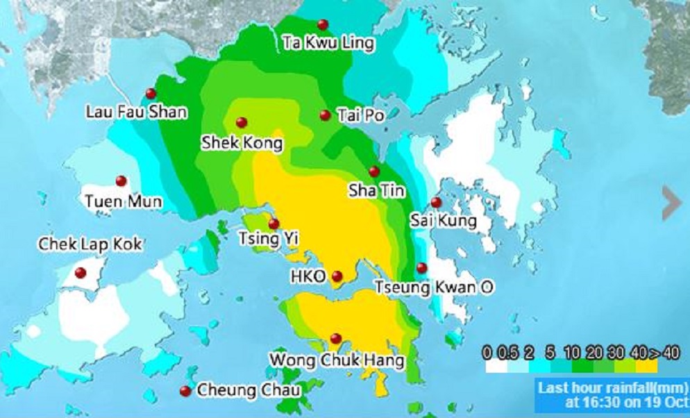
Yellow indicates areas where over 40 millimetres of rainfall have occurred in the last hour. The worst-affected areas are concentrated on Hong Kong and Kowloon. Screenshot: Hong Kong Observatory
According to the Observatory’s map, the rainfall has been most severe on Hong Kong Island and the southern and central parts of Kowloon.
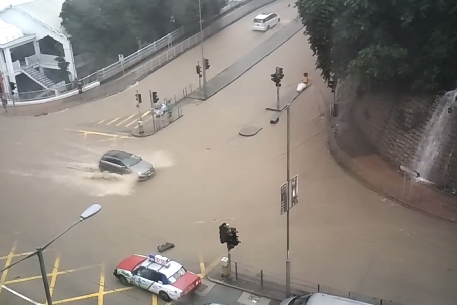
Footage of flooded roads have been shared widely on social media. One particularly popular clip uploaded an hour ago shows a birds eye view of the intersection of Queen’s Road East and Stubb’s Road in Wan Chai:
Eastern parts of the island appear to also be badly affected, such as King’s Road in Fortress Hill:
Chai Wan:
Across the harbour, parts of Yau Tsim Mong appear to be so severely flooded that one van driver was pictured abandoning his vehicle.
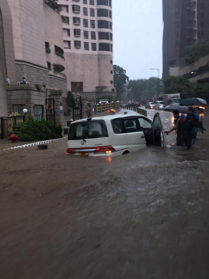 Photo: Yenug Ivy via Facebook
According to the HKO, the rain will ease overnight and conditions will improve tomorrow. However they will issue a T1 Standby Signal tomorrow morning as Typhoon Haima is expected to move across the Philippine island of Luzon and enter the South China Sea.
The typhoon is predicted to affect Hong Kong most on Friday, when it may come within 100 kilometres of the territory. Heavy rain and frequent squalls are expected.
Got a tip? Send it to us at hongkong@coconuts.co

