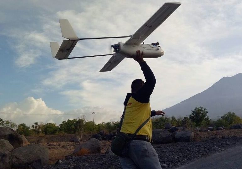

The heavy-duty drone that the National Disaster Mitigation Agency (BNPB) just deployed this week to monitor Bali’s smoking and rumbling volcano crashed on Thursday, its second day of duty.
The Koax 3.0—which BNPB had boasted could go up to 4,000 meters—had a faulty takeoff and crashed into a bridge near the “runway” in Tulamben, Kubu.
The crash resulted in damage to the drone’s blades, camera, as well as the aircraft body.
The day before, the drone had to come back down on its maiden flight after its camera suffered damage when flying at an altitude of 1,800 meters.
Some locals believe that the drone’s failure to launch could be a sign from the angry volcano. Mount Agung, Bali’s highest peak at 3,031 meters, is regarded as scared by Balinese Hindus. So whatever goes over the volcano must be “clean,” say local priests.
The drone had gone through a blessing and cleansing ceremony, before taking off, but apparently it just wan’t good enough.
“We believe Mount Agung is very sacred. Anything that goes to Mount Agung should be clean and blessed,” said Ida Rsi Satya Artha Dharma Sadu Para Dwija Para, who had led the ceremony to ‘sterilize’ the drone.
BNPB says it plans to use another of its five drones on Friday to try and observe Mount Agung’s crater.
The drone’s flight failure could also be explained by challenging wind speeds and thin air density, says Agus, the drone pilot.
“Maybe the air density here is too thin and makes the thrust less. We will try again next morning when the air is more thick. However, it’s usually less sunny in the morning, so shooting conditions are less than optimal,” Agus said on Thursday, as quoted by Tribun Bali.
The Volcanology and Geological Disaster Mitigation Center (PVMBG) reinforced the drone pilot’s conjecturing.
“With these drones we hope to get more precise results, closer to the crater. With drones, we can get continuous visuals, because for satellite imaging, we usually only get it over five days.
“But it’s not easy to fly drones over Mount Agung because of the difficult terrain conditions, high wind speeds, and the high altitude of Mount Agung, which is also relatively high so it takes more effort. We have not yet succeeded in getting a visual of the crater,” PVMBG senior volcanologist Devy Kamil said.
To see the latest status of Mount Agung, which has been on the highest alert for a volcanic eruption since Sept. 22, check out a livestream set up of the volcano. While the livestream of course doesn’t offer a crater view, you can at least see what’s going on from two different vantage points in real time.


Jennifer Dube says
Do not allow Toxic Trump to destroy beautiful Bali! I was just in Bali back in April and it would be horrible to go back and see damage done by Trump who is NOT an environmentalist. Bali must stop his plans! Trump is BAD for Bali!